Towner's Woods Trail
check with the trail manager for updated details before visiting.
Towner's Woods Trail
City, Town, or County
Backcountry Trail
Frontcountry Trail
- Length
6 miles
- Elevation Gain
--
- Route Type
out & back
- Length
6 miles - Elevation Gain
-- - Route Type
out & back
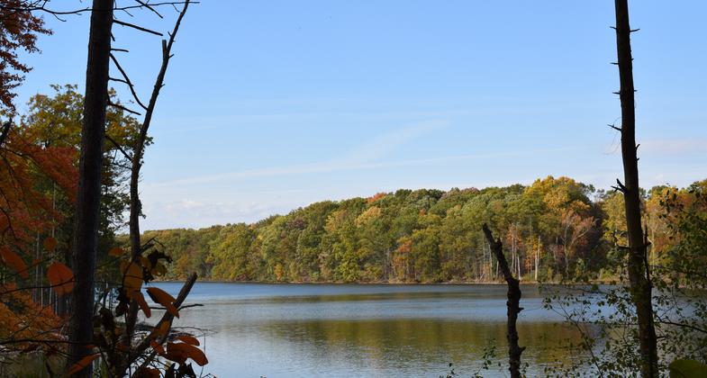
Trail passes by a lake, woods, wetlands, and old fields.
Location: NW of Ravenna at Towner's Woods Park, Portage County.
- States: Ohio
Towner's Woods was acquired in phases by Portage County in the 1970s as a potential water supply, with a later addition by the Park District. It was developed as a parkland and opened to the public in 1975. The property consists of 234 rolling acres of mixed forests, diverse wetlands, and meadows in Franklin and Ravenna Townships. The park is next to Lake Pippen, a pristine glacial kettle hole lake owned by the City of Akron. Foot trails throughout the park provide easy to strenuous hiking and renowned cross-country skiing through beautiful natural scenery and varied habitats.
Historically, 2,000 years ago the Hopewell Indians created a burial mound, located overlooking Lake Pippen which was excavated in the early 1900s. Towner's Woods and The PORTAGE Hike and Bike Trail are also located on the key Erie Railroad line. The 1913 Brady Interlocking Switch Tower was used to switch the lower set of train tracks (now Norfolk Southern). Now just used for storage, the building has great potential for other uses.
Accessibility Information
No text provided.
Allowed Uses:
Hiking/WalkingPublic Contact
Portage Co Parks & Recreation Dept.449 South Meridian
Ravenna, OH 44226
Contact the trail manager for current maps and visiting details.
More Details
- Elevation (low): --
- Elevation (high): --
- Elevation (cumulative): --
- Part of a Trail System? No
- Surface (primary): --
- Surfaces (additional): --
- Tread Width (average): 0"
- Tread Width (minimum): --
- Running length (minimum): --
- Tread Grade (average, percent): --
- Tread Grade (maximum):
- Running length (maximum): --
- Cross-slope (average, percent): --
- Cross-slope (maximum): --
- Running length (maximum): --
- Certified as an NRT
May 31, 1979


