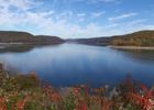
Tracy Ridge Trail
This information is a public record of the 1979 NRT application and may be out of date if it has not been updated by a trail manager --
check with the trail manager for updated details before visiting.
check with the trail manager for updated details before visiting.
Tracy Ridge Trail
USDA Forest Service
Backcountry Trail
- Length
4.58 miles
- Elevation Gain
--
- Route Type
out & back
- Length
4.58 miles - Elevation Gain
-- - Route Type
out & back
Location: Tracy Ridge National Recreation Area, In Allegheny National Forest off State Route 321, d. 15 mi. west of Bradford.
- States: Pennsylvania
- Counties: McKean
Wander beneath the oak trees on the 33.69-mile-long Tracy Ridge Hiking Trail. Explore small groves of hemlock along the streams. Slopes along the reservoir and the eight small streams in the area are steep. Rock ledges and large boulders can be found on the steeper hillsides.
The trail begins at 2,245 feet on the flat ridgetop at Tracy Ridge Recreation Area, and takes visitors through the Allegheny National Recreation Area before passing by the Allegheny Reservoir at multiple locations.
Accessibility Information
No text provided.
Allowed Uses:
Boating, motorizedOther Activities
- Camping
Public Contact
Bradford Ranger DistrictTracy Ridge NRA
Bradford, PA 16701
anf/[email protected] • (814) 362-4613
www.fs.fed.us/r9/allegheny
Contact the trail manager for current maps and visiting details.
More Details
- Elevation (low): 1328
- Elevation (high): 2245
- Elevation (cumulative): --
- Part of a Trail System? No
- National Designations: National Millennium
- Surface (primary): Soil
- Surfaces (additional): Soil
- Tread Width (average): 24"
- Tread Width (minimum): --
- Running length (minimum): --
- Tread Grade (average, percent): 8
- Tread Grade (maximum): 18
- Running length (maximum): --
- Cross-slope (average, percent): --
- Cross-slope (maximum): --
- Running length (maximum): --
- Certified as an NRT
Feb 6, 1979


