Trail of the Molten Lands
check with the trail manager for updated details before visiting.
Trail of the Molten Lands
USDA Forest Service
Backcountry Trail
- Length
0.75 miles
- Elevation Gain
--
- Route Type
Loop
- Length
0.75 miles - Elevation Gain
-- - Route Type
Loop
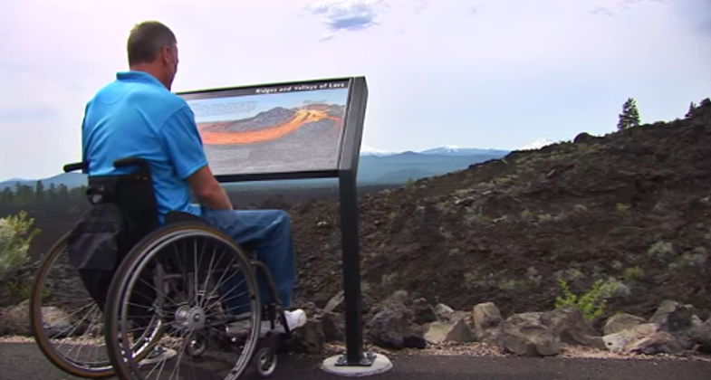
This is a paved, barrier-free interpretive trail running through the heart of a lava flow from the Lava Lands Visitor Center parking lot.
Location: Lava Lands Visitor Center. Deschutes National Forest, Bend-Fort Rock Ranger District, at Lava Butte, 12 mi. south of Bend.
- States: Oregon
- Counties: Deschutes
From Lava Lands Visitor Center in the Newberry National Volcanic Monument, this trail loops out across the basalt lava flow for a little over a mile to its source at the base of Lava Butte. One-third of the trail is a newly reconstructed section that is Universally Accessible. Older sections of the trail have grades and surfaces that may be challenging without assistance. Eleven new full-color interpretive signs tell the story of the eruption of Lava Butte and the life that now makes the lava their home.
Accessibility Information
No text provided.
Allowed Uses:
Dogs, on leash Hiking/WalkingOther Activities
- Wildlife viewing / observation
Public Contact
Marv LangDeschutes National Forest
Bend-Fort Rock Ranger District
Bend, OR 97701
[email protected] • (541) 383-4793
www.fs.fed.us/r6/centraloregon
Contact the trail manager for current maps and visiting details.
More Details
- Elevation (low): 4500
- Elevation (high): 4550
- Elevation (cumulative): --
- Part of a Trail System? No
- Surface (primary): Paved
- Surfaces (additional): Paved
- Tread Width (average): 30"
- Tread Width (minimum): --
- Running length (minimum): --
- Tread Grade (average, percent): 4
- Tread Grade (maximum): 6
- Running length (maximum): --
- Cross-slope (average, percent): --
- Cross-slope (maximum): --
- Running length (maximum): --
- Certified as an NRT
Jun 28, 1979


