Trail of the Restless Waters
check with the trail manager for updated details before visiting.
Trail of the Restless Waters
USDA Forest Service
Backcountry Trail
- Length
0.4 miles
- Elevation Gain
--
- Route Type
out & back
(1 review)
- Length
0.4 miles - Elevation Gain
-- - Route Type
out & back
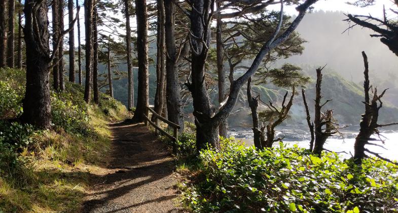
This paved National Recreation Trail hugs the coastline offering views of crashing waters, volcanic terraced tidepools and wind sculpted spruce.
Location: Waldport, OR., At Cape Perpetua, just south of Yachats.
- States: Oregon
- Counties: Lincoln
A wild place to see the winter surf as it explodes onto the terraces of volcanic rock. Don't get too close to the edge; each wave hits the rocks differently and you don't want to get soaked. Always use caution on the beach and at the tidepools.
Accessibility Information
No text provided.
Reviews
Paved path, but a beautiful walk.
The trail is paved, which is not typically a preference for myself, but this trail is a favorite none the less. The views are spectacular. There are options to make this trail into a longer loop, connecting up onto Cape Perpetua -- just follow the signs.
Allowed Uses:
Dogs, on leash Hiking/WalkingOther Activities
- Wildlife viewing / observation
Public Contact
Margie PaceUS Forest Service
855 Hwy. 101
Reedsport, OR 97467
[email protected] • (541) 271-6072
www.fe.fed.us/r6/siuslaw/siurec
Contact the trail manager for current maps and visiting details.
More Details
- Elevation (low): 50
- Elevation (high): 60
- Elevation (cumulative): --
- Part of a Trail System? No
- Surface (primary): Paved
- Surfaces (additional): Paved, Boardwalk
- Tread Width (average): 48"
- Tread Width (minimum): --
- Running length (minimum): --
- Tread Grade (average, percent): 8
- Tread Grade (maximum): 12
- Running length (maximum): --
- Cross-slope (average, percent): --
- Cross-slope (maximum): --
- Running length (maximum): --
- Certified as an NRT
Dec 7, 1978


