Trinity River Paddling Trail
check with the trail manager for updated details before visiting.
Trinity River Paddling Trail
Nonprofit
National Water Trail
- Length
130 miles
- Elevation Gain
--
- Route Type
out & back
(1 review)
- Length
130 miles - Elevation Gain
-- - Route Type
out & back
The Trinity River Paddling Trail consists of 130 miles of river accessed by 21 official launch sites. The paddling trail traverses 9 municipalities including Dallas and Ft. Worth, and is located in the middle of America's 4th largest metro area with a population of 7.5 million people. Over 5 million people live within 30 minutes drive of the trail.
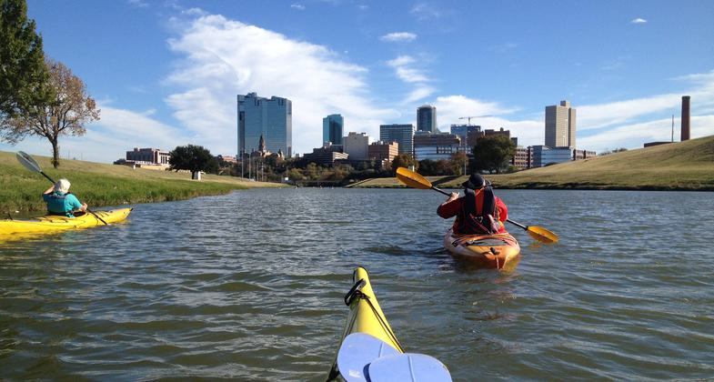
West Fork view of Cowtown. Photo by Teresa Patterson
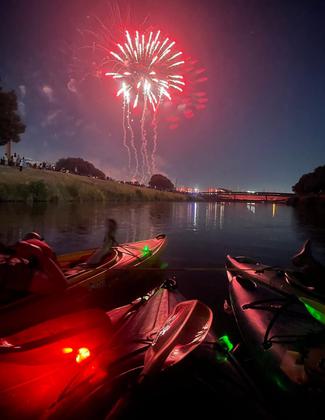
Winner 2022 NRT Photo Contest, Paddling and Water Trails. Photo by Teresa Patterson, Trinity Coal.

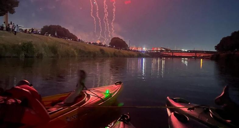
Kayak Christmas on the Trinity Clear Fork. Photo by Teresa Patterson.

Near the confluence of the Clear and West Fork near Fort Worth. Photo by Teresa Patterson.
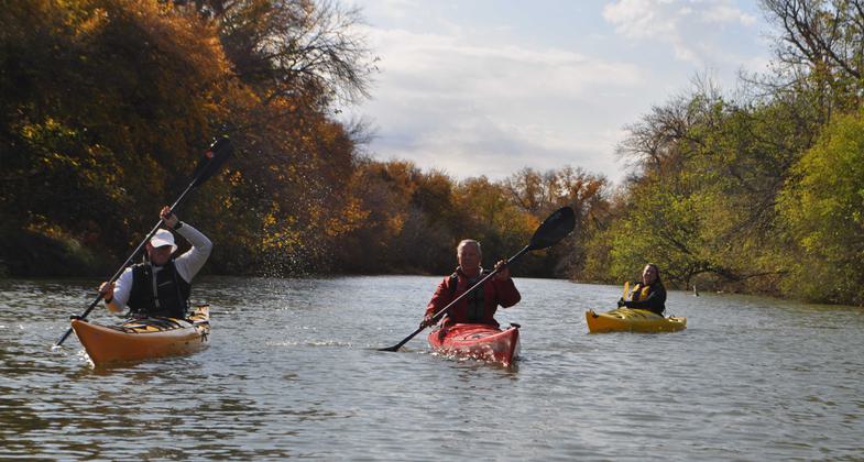
Elm Fork near Las Colinas. Photo by Teresa Patterson.
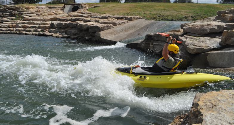
2020 NRT Photo Contest Winner - Water Trails. Photo by Teresa Patterson.
Location: The trail location is the Trinity River including Fort Worth, Lewisville, Dallas and 6 other cities. This trail, Trinity River Paddle Trail is 130 miles long with 21 existing access points.
- States: Texas
- Counties: Tarrant, Dallas, Denton
- Cities/Townships: Fort Worth, Arlington, Grand Prairie, Irving, Carrollton, Lewisville, Dallas, Farmers Branch, Coppell
Trinity River Paddling Trail Summary Description
The Trinity River Paddling Trail consists of 130 miles of river accessed by 21 official launch sites. The paddling trail traverses 9 municipalities including Dallas and Ft. Worth, and is located in the middle of America's 4th largest metro area with a population of 7.5 million people. Over 5 million people live within 30 minutes drive of the trail.
Over the years, the cities on the banks of the Trinity River have built a number of amenities accessed by the river. Currently, there are 5 learning centers, over 50 Parks and preserves, and many miles of paved hike/bike trails adjacent to the paddling trail.
The Trinity River is a major water source for the state of Texas, with approximately half of all the state's residents receiving their drinking water from the river. The paddling trail incorporates 3 major tributaries of the river, including the Clear Fork, West Fork, and Elm Fork. The final 40 miles of the trail are the start of the river's Main Branch, which begins on the southern edge of Dallas' central business district, and then exits Dallas County's southern boundary on the way to the Gulf of Mexico at Galveston Bay.
Throughout history, the Trinity River has been a significant part of the life of this part of America's southwest. Native Americans built settlements on the river banks, as evidenced by a 3,000-year-old spearhead recently found near the river by a student on a field trip organized by one of the learning centers. President Sam Houston camped on the river bank at Big Spring while he was negotiating a landmark treaty with the Native Americans in the 1840s. The California Crossing canoe launch site that is part of the paddling trail is named for the section of the river crossed by the 49ers on their way west to California in the gold rush.
As the Trinity River Paddling Trail receives more attention as part of the National Park Service's Recreation Trail System, usage is expected to significantly increase, and more launch sites are expected to be built. Eventually, the paddling trail may even be extended the remaining 375 miles from its current end all the way to the Gulf of Mexico.
Over the last few years, Dallas has focused on the underserved communities, which are primarily southern Dallas. Along with Dallas, the Trinity Coalition's mission is to include the people of southern Dallas and southern Dallas County, all underserved communities, in participating in their paddling trails. Southern Dallas and Southern Dallas County are the starts of the Great Trinity Forest, the largest urban hardwood forest in America. The city has created a natural preserve around some natural springs in southern Dallas. The Trinity Coalition and the Army Corps of Engineers, working with the city of Dallas, have opened several recreational activities, including hiking and biking trails. Please see http://dallastrinitytrails.blo...
Dallas and the Trinity Coalition have also helped open some commercial interests including an equestrian center and a word class golf course. The idea of a National Recreation Trail was actually born out of intercity cooperation with the Trinity Coalition. The TC is planning the next three river access points to be in southern Dallas and Southern Dallas County.
The Trinity River Paddling Trail has five learning centers along its banks with the largest and most active being the Trinity River Audubon Center (TRAC) in southern Dallas on the banks of the Trinity River in an underserved community. Residents of that area are given free admission to TRAC, with the $6 admission fee being waived.
Accessibility Information
No text provided.
Reviews
Great Paddling
I have only been on the Trinity River in my kayak at two access points, but both times, I found it to be a pleasant experience. The access on Hebron Road is first class . The river is scenic and provides lots of opportunities to see birds and other wildlife. I am so happy to see our beautiful river as a part of the National Water Trails System.
Allowed Uses:
Boating, motorized Boating, human-poweredOther Activities
- Fishing
- Heritage and history
- Wildlife viewing / observation
Public Contact
Stephen SmithTrinity Coalition
100 Crescent Court
Dallas, TX 75201
[email protected] • (214) 880-4601
More Details
- Elevation (low): --
- Elevation (high): --
- Elevation (cumulative): --
- Part of a Trail System? No
- State Designations: Texas Parks and Wildlife Paddle Trail
- Surface (primary): --
- Surfaces (additional): Rock, boulders, Rock, smooth, Water, calm
- Tread Width (average): 0"
- Tread Width (minimum): 0
- Running length (minimum): --
- Tread Grade (average, percent): --
- Tread Grade (maximum):
- Running length (maximum): --
- Cross-slope (average, percent): 0
- Cross-slope (maximum): --
- Running length (maximum): --
- Certified as an NRT
Oct 25, 2020

