Trooper Trail
check with the trail manager for updated details before visiting.
Trooper Trail
USDA Forest Service
Backcountry Trail
- Length
3 miles
- Elevation Gain
--
- Route Type
out & back
- Length
3 miles - Elevation Gain
-- - Route Type
out & back
Trooper Trail Loop is approximately 10.5 miles access from Middle and South Fork Trailheads.
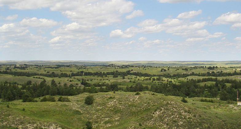
Nebraska National Forest. The largest human-planted forest in the US. Photo by Bkell.
Location: Adjacent to and in Soldier Creek Wilderness, In Nebraska National Forest, W of Ft. Robinson, N of US 20.
- States: Nebraska
- Counties: Sioux
Soldier Creek Wilderness was created by an act of Congress in 1986 and is managed by the U.S. Forest Service. It covers an area of 7,794 acres within the Pine Ridge section of the Nebraska National Forest bordering Fort Robinson State Park.
The region, which was originally established as a timber reservation for nearby Fort Robinson, was utilized by the U.S. Cavalry from the late 19th century through World War II for its excellent horse pastures along Soldier Creek. The area now provides habitat for elk, white-tailed deer, mule deer, turkeys, coyotes, bobcats, eagles, hawks, the threatened Bald eagle, and numerous other wildlife. Here the ponderosa pine-covered ridges of northwest Nebraska give way to grassy upland parks.
The Wilderness is recovering from a wildfire that destroyed about 90 percent of the pine trees in 1989, which is slowly rebounding. Several well-developed trails loop through the area. A series of trails pass two windmills that are still functioning, even though they are not maintained and are over 100 years old. A popular destination for horseback riding, the wilderness is the larger of the two federally-designated wilderness areas in Nebraska. Horse packers can saddle up at the Soldier Creek Trailhead corral.
Accessibility Information
No text provided.
Allowed Uses:
Equestrian Hiking/WalkingOther Activities
- Camping
- Fishing
- Wildlife viewing / observation
Public Contact
Nebraska National Forest16524 Hwy. 385
Chadron, NE 69337
[email protected] • (308) 432-4475
www.fs.fed.us/r2/nebraska
Contact the trail manager for current maps and visiting details.
More Details
- Elevation (low): 4250
- Elevation (high): 4700
- Elevation (cumulative): --
- Part of a Trail System? No
- Surface (primary): Soil
- Surfaces (additional): Soil
- Tread Width (average): 18"
- Tread Width (minimum): --
- Running length (minimum): --
- Tread Grade (average, percent): 5
- Tread Grade (maximum): 40
- Running length (maximum): --
- Cross-slope (average, percent): --
- Cross-slope (maximum): --
- Running length (maximum): --
- Certified as an NRT
Dec 12, 1979