Tualatin River Water Trail
check with the trail manager for updated details before visiting.

Tualatin River Water Trail
Nonprofit
National Water Trail
- Length
38.5 miles
- Elevation Gain
--
- Route Type
out & back
- Length
38.5 miles - Elevation Gain
-- - Route Type
out & back
The Tualatin River Water Trail currently has public facilities serving 39 miles of river from Hillsboro Oregon to its confluence with the Willamette River in West Linn Oregon. Future development of public park property will someday extend public access upstream to Cornelius.

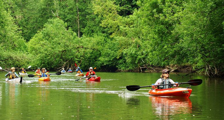
Photo by Nalia tv


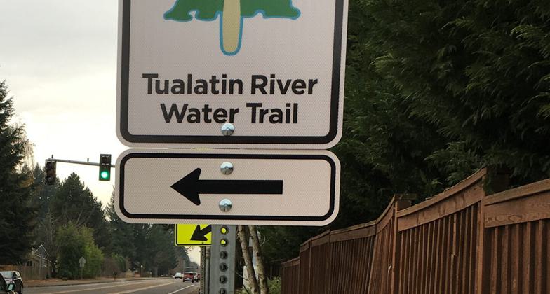
Water Trail Road Sign on Durham Road

Water Trail Map at Eagle Landing
Location: In Washington County and Clackamas County Oregon including the cities of Hillsboro, Tigard, Tualatin, Rivergrove and West Linn and passing through the Tualatin River National Wildlife Refuge.
- States: Oregon
- Counties: Washington, Clackamas
- Cities/Townships: Hillsboro, Sherwood, Tigard, Tualatin, Durham, Rivergrove, West Linn
The Tualatin River Water Trail currently has public facilities serving 39 miles of river from Hillsboro Oregon to its confluence with the Willamette River in West Linn Oregon. Future development of public park property will someday extend public access upstream to Cornelius.
The Tualatin River Water Trail runs through farmlands, cities, and the Tualatin River National Wildlife Refuge. It provides convenient access for paddling, fishing, and wildlife observation in the Portland Oregon Metropolitan area. Eleven developed launch sites managed by city, county, and regional governments currently support the trail. Informal access occurs at road right-of-ways under 2 bridges. Metro Regional Government and the City of Tigard have acquired three additional parcels for future access development. Excellent promotion and marketing of the Tualatin River Water Trail are provided by Washington County Visitors Association and the Intertwine Alliance. Ecological and flow management is provided by Clean Water Services (a regional service district). Regional planning for habitat restoration and public access is provided by Metro (regional government). U.S. Fish and Wildlife Service manages 2000 acres at various locations along the water trail. The Tualatin River has significance as the first water body to successfully implement Total Maximum Daily Loads (water quality standards) under the Federal Clean Water Act. Tualatin Riverkeepers and Alder Creek Kayak and Canoe currently offer canoe and kayak rentals at two sites on the river in the summer. Tualatin Riverkeepers offers regular public guided trips. Washington County Visitors Association has funded new wayfinding signage for the trail. Tualatin Riverkeepers placed river mile signage along the river since 1990. Roamers Rest RV Park (privately owned) provides the only camping facility currently on the river.
The US Army Corps of Engineers has determined that the Tualatin River is navigable from the mouth of Gales Creek at river mile 56.8 to the Willamette River.
Accessibility Information
No text provided.
Allowed Uses:
Boating, motorized Boating, human-powered SwimmingOther Activities
- Fishing
- Heritage and history
- Hunting
- Wildlife viewing / observation
Public Contact
Tualatin Riverkeepers11675 SW Hazelbrook Road
Tualatin, OR 97062
[email protected] • (503) 218-2580
www.tualatinriverkeepers.org
More Details
- Elevation (low): --
- Elevation (high): --
- Elevation (cumulative): --
- Part of a Trail System? No
- Surface (primary): --
- Surfaces (additional): Rock, boulders, Water, calm
- Tread Width (average): 0"
- Tread Width (minimum): 0
- Running length (minimum): --
- Tread Grade (average, percent): --
- Tread Grade (maximum):
- Running length (maximum): --
- Cross-slope (average, percent): 0
- Cross-slope (maximum): --
- Running length (maximum): --
- Certified as an NRT
Oct 25, 2020


