Twin Arches Loop Trail
check with the trail manager for updated details before visiting.
Twin Arches Loop Trail
National Park Service
Backcountry Trail
Frontcountry Trail
- Length
6 miles
- Elevation Gain
--
- Route Type
Loop
- Length
6 miles - Elevation Gain
-- - Route Type
Loop

The South Twin Arch at the Big South Fork National River and Recreation Area in Scott County, Tennessee, USA. Photo by Brian Stansberry.

North Twin Arch. Photo by Chuck Sutherland.

The North Twin Arch at the Big South Fork National River and Recreation Area in Scott County, Tennessee, USA. Photo by Brian Stansberry.

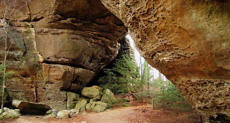
The underside of the South Twin Arch at the Big South Fork National River and Recreation Area in Scott County, Tennessee, USA. Photo by Brian Stansberry.

View of the Upper Station Camp Creek valley, from the end of the Twin Arches Trail . Photo by Brian Stansberry/wiki.
Location: At Big South Fork NRRA, begins at Charit Creek Hostel, 25 mi. NE of Jamestown on SR 154.
- States: Tennessee
The Twin Arches Trail and Loop Trail have some geological features in Big South Fork, and the Twin Arches are truly the most impressive rock arches in the eastern United States. The North Arch has a clearance of 51 feet, a span of 93 feet, and its deck is 62 feet high; South Arch has a clearance of 70 feet, a span of 135 feet, and its deck is 103 feet high.
The Twin Arches Trail is a .7-mile walk that will bring you to the Twin Arches and the Twin Arches Loop Trail. By following the Twin Arches Loop clockwise, you will descend about 400 feet from the arches to Charit Creek Lodge. At the Lodge, you will find restrooms, accommodations, and maybe even some refreshments. From there the trail follows along Station Camp Creek to an old home site known as Jake's Place. Past Jake's Place the trail once again climbs almost to the top of the plateau and follows the base of a cliff line back to the Twin Arches. Along this section are several huge rock shelters once used by Native Americans, early settlers, and even niter miners.
Upon reaching the Twin Arches you may return to the parking lot by climbing the stairs between the arches and following the Twin Arches Trail back.
Accessibility Information
No text provided.
Allowed Uses:
Hiking/WalkingPublic Contact
South Big Fork NRAP.O. Drawer 630
Oneida, TN 37841
Contact the trail manager for current maps and visiting details.
More Details
- Elevation (low): --
- Elevation (high): --
- Elevation (cumulative): --
- Part of a Trail System? No
- Surface (primary): --
- Surfaces (additional): --
- Tread Width (average): 0"
- Tread Width (minimum): --
- Running length (minimum): --
- Tread Grade (average, percent): --
- Tread Grade (maximum):
- Running length (maximum): --
- Cross-slope (average, percent): --
- Cross-slope (maximum): --
- Running length (maximum): --
- Certified as an NRT
May 19, 1986

