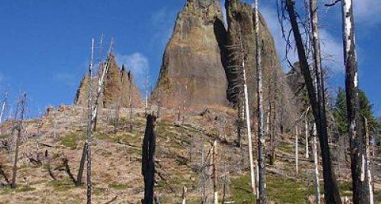
Twin Pillars
This information is a public record of the 1979 NRT application and may be out of date if it has not been updated by a trail manager --
check with the trail manager for updated details before visiting.
check with the trail manager for updated details before visiting.
Twin Pillars
USDA Forest Service
Backcountry Trail
- Length
8.5 miles
- Elevation Gain
--
- Route Type
out & back
- Length
8.5 miles - Elevation Gain
-- - Route Type
out & back
The Mill Creek Wilderness is a fairly small, fairly unknown wilderness area in Eastern Oregon, about 15 miles northeast of Prineville.
Location: Mill Creek Wilderness, east of Prineville
- States: Oregon
- Counties: Crook
The "mountains" are more like hills, reaching 6000 feet in elevation. Mill Creek runs through the middle of it. From the creek, you can see the surrounding hills of the wilderness. The trail goes up to summit ridges, from where you can see Mill Creek and glimpses of the surrounding area including the Three Sisters in the Cascades. There are a number of interesting rock spires, including the Twin Pillars which the trail passes close to.
Accessibility Information
No text provided.
Allowed Uses:
Equestrian Hiking/WalkingOther Activities
- Camping
Public Contact
Ochoco National ForestP.O. Box 490
Prineville, OR 97754
Contact the trail manager for current maps and visiting details.
More Details
- Elevation (low): --
- Elevation (high): --
- Elevation (cumulative): --
- Part of a Trail System? No
- Surface (primary): Soil
- Surfaces (additional): --
- Tread Width (average): 0"
- Tread Width (minimum): --
- Running length (minimum): --
- Tread Grade (average, percent): --
- Tread Grade (maximum):
- Running length (maximum): --
- Cross-slope (average, percent): --
- Cross-slope (maximum): --
- Running length (maximum): --
- Certified as an NRT
Oct 4, 1979


