Two Lakes Loop
check with the trail manager for updated details before visiting.
Two Lakes Loop
USDA Forest Service
Backcountry Trail
- Length
16 miles
- Elevation Gain
--
- Route Type
Loop
- Length
16 miles - Elevation Gain
-- - Route Type
Loop
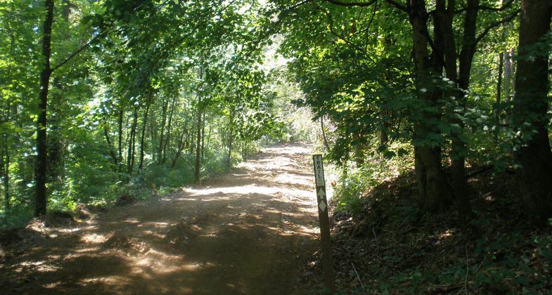
The Two Lakes Trail is a 16-mile loop encircling Indian and Celina Lakes, and winds through many acres of diverse forest and wildlife openings. Half of the trail is on steep slopes and half is easy to hike. Hikers should allow several hours to hike the entire trail.

Photo by Nancy Myers.

Side Hill Trail. Photo by USFS.

Photo by Nancy Myers.

Bluffs along trail. Photo by USFS.
Location: In the Hoosier National Forest within the Indiana-Celina Recreation Area.
- States: Indiana
- Counties: Perry
- Cities/Townships: Clark Township
The Two Lakes Trail is a 16-mile loop encircling Indian and Celina Lakes, traverses two dams, and winds through many acres of diverse forest and wildlife openings. Half of the trail is on steep slopes and half is easy to hike. Hikers should allow several hours to hike the entire trail. The trail is conveniently located at the campground in the Indian-Celina Recreation Area. The trail features scenic views of Celina and Indian Lakes, rock outcrops, and a variety of forest types including tall pine, native hardwoods, and bottomland species. The area is also a wildlife viewing area with deer and many species of birds. The trail includes several cutoffs creating many options for loops and trail lengths. The 1-mile interpretive trail to the historic Rickenbaugh House is linked to the Two Lakes Trail and passes by the historic site and the Celina Lake Boat Ramp.
Twelve interpretive stops are signed along the interpretive trail. The Two Lakes Trail is a combination of old roads and a laid-out trail. Historically some of the county roads were used to travel between Uniontown and the community of Celina. The Two Lakes Trail area was once settled and there is evidence of old homesites. Please do not disturb or remove anything from homesites. Backpackers particularly like the Two Lakes trail as it is the longest hiking-only trail in the Tell City Ranger District of the Hoosier National Forest. The trail also gets a lot of use from Scout groups and both local and out-of-state visitors. An annual half-marathon special event is held on the Two Lakes Trail in early summer. This year the event attracted 132 runners.
The Two Lakes Trail is maintained by the Forest Service, it is logged out and mowed several times a year. Primitive camping is allowed off the trail and there are designated campsites. Please camp at least 100 feet from the trail and water sources. There is water available at creeks including a fork of the Anderson River. The trail also crosses several creeks and the fork of the Anderson River can be high after heavy rains. There is evidence of storms as there is heavy blowdown of pine trees that can be seen on the north loop of the trail north of Indian Lake. The Two Lakes Trail also runs concurrently with a segment of the American Discovery Trail. Hunting is allowed, please use caution during hunting seasons and wear orange clothing. Please pack out trash. The main trail is well-signed and is marked with white diamonds, connector trails are marked with orange diamonds. You are Here signs are placed at intersections and various points along the trail to orient hikers.
Accessibility Information
No text provided.
Allowed Uses:
Swimming Dogs, on leash Hiking/WalkingOther Activities
- Camping
- Fishing
- Hunting
Public Contact
Nancy MyersHoosier National Forest
248 15th St.
Tell City, IN 47586
[email protected] • (812) 547-7051
www.fs.fed.us/r9/hoosier
Contact the trail manager for current maps and visiting details.
More Details
- Elevation (low): 550
- Elevation (high): 800
- Elevation (cumulative): --
- Part of a Trail System? No
- National Designations: American Discovery Trail
- Surface (primary): Soil
- Surfaces (additional): Soil
- Tread Width (average): 120"
- Tread Width (minimum): --
- Running length (minimum): --
- Tread Grade (average, percent): 10
- Tread Grade (maximum): 20
- Running length (maximum): --
- Cross-slope (average, percent): --
- Cross-slope (maximum): --
- Running length (maximum): --
- Certified as an NRT
Dec 12, 1979

