Two Top Snowmobile Trail (addition)
check with the trail manager for updated details before visiting.
Two Top Snowmobile Trail (addition)
USDA Forest Service
Backcountry Trail
- Length
43 miles
- Elevation Gain
--
- Route Type
out & back
- Length
43 miles - Elevation Gain
-- - Route Type
out & back
Two Top Trail is a popular choice for its variety of terrain and 2,000-foot elevation gain.
Location: Just west of West Yellowstone south of Targhee Pass, access at airport. (expanded in 1979)
- States: Idaho
- Counties: Fremont
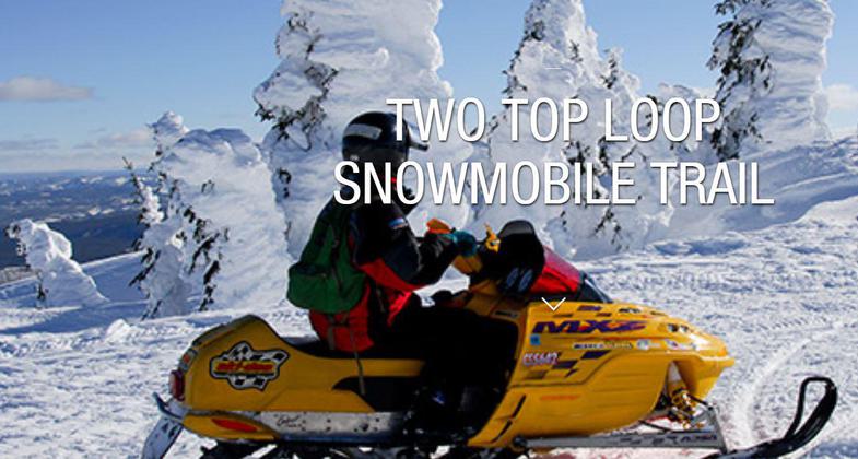
See the snow ghosts of Two Top on the most famous trail in all of North America! Two Top Trail is a popular choice for its variety of terrain and 2,000-foot elevation gain. The trail is groomed, and powder fields abound. This trail has everything and makes it one of the most visited trails in the system. Whether you are a novice or an expert, you will enjoy this well-groomed trail. This trail is a large loop with plenty of extra off-trail riding for those in search of more adventure. There are numerous bowls out there with drop-offs and overhanging cliffs. The bowls are great to ride, but make sure you know where you are out there.
On clear days you can view the Teton Mountains and be treated to an incredible panorama of the entire region. From the upper areas, the surrounding mountain ranges come into view, including Wyoming's Teton's, Idaho's Centennial Mountains, Lionhead in Montana, and Yellowstone National Park. Constant-driven winds create ghostly ice patterns plastered on the trees at the top of this mountain creating the famous "snow ghosts."
Accessibility Information
No text provided.
Allowed Uses:
Dogs, on leash Hiking/Walking Motorized vehicles, – ATV/ORV Motorized vehicles, snowmobiling Snow, cross-country skiing Snow, snowshoeingOther Activities
- Camping
- Snow, snow play general
Public Contact
Roben JenkinsTarghee National Forest
HC 66 Box 975
, ID 83429
[email protected] • (208) 558-7301
Contact the trail manager for current maps and visiting details.
More Details
- Elevation (low): --
- Elevation (high): --
- Elevation (cumulative): --
- Part of a Trail System? No
- Surface (primary): Snow or ice
- Surfaces (additional): Soil
- Tread Width (average): 127"
- Tread Width (minimum): --
- Running length (minimum): --
- Tread Grade (average, percent): --
- Tread Grade (maximum):
- Running length (maximum): --
- Cross-slope (average, percent): --
- Cross-slope (maximum): --
- Running length (maximum): --
- Certified as an NRT
Dec 12, 1979


