Uwharrie Trail
check with the trail manager for updated details before visiting.
Uwharrie Trail
USDA Forest Service
Backcountry Trail
- Length
20.4 miles
- Elevation Gain
--
- Route Type
out & back
- Length
20.4 miles - Elevation Gain
-- - Route Type
out & back
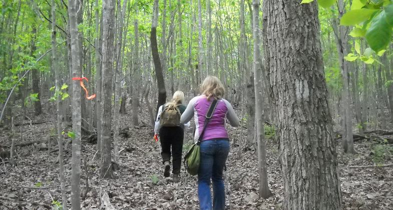
The Uwharrie National Recreation Trail offers a variety of scenery, streams, and rocky terrain. The trail can be hiked in long or short sections, as the trail crosses several access points. The trail is marked with white blazes.
Location: Uwharrie Ranger District, In Uwharrie National Forest, connects SR 24/27at PeeDee R. W to SR 1142.
- States: North Carolina
- Counties: Montgomery
Dutchman's Creek Trail, marked with yellow blazes, starts at the same point as the Uwharrie Trail, at the parking lot on Hwy 24/27, and was constructed as a loop system to be used as an alternate route when hiking the southern portion of the Uwharrie Trail. Dark Mountain, on the northern portion of the trail, offers an excellent western view. Camping areas along the trail include Wood Run Hunt Camp, Yates Place Camp, West Morris Mountain Campground, and other primitive camps. Old home sites, cemeteries, and gold mines exist along or near the trail.
Hikers can thank an old-time trapper's son, Joe Moffit of Asheboro, for this trail. He blazed it over 25 years ago. Moffit grew up in the Uwharrie Mountains during the Great Depression and learned to live off the land at an early age. Moffit was a Scoutmaster when he started the Uwharrie Trail project in 1972 to help his Boy Scouts earn their Eagle rank. They completed the now well-known path in 1975 and founded the Uwharrie Trail Club.
There are plenty of streams in the forest, but all drinking water should be treated with a water purification kit before use. Ticks plague the forest and can be kept at bay with repellent or the new mesh clothing on the market. Always keep a watch for the timber rattlesnakes and copperheads that live in these woods.
Accessibility Information
No text provided.
Allowed Uses:
Hiking/WalkingOther Activities
- Camping
- Wildlife viewing / observation
Public Contact
Theresa SaveryUwharrie Ranger District
789 NC Hwy. 24/27 East
Troy, NC 27371
[email protected] • (910) 576-6391
Contact the trail manager for current maps and visiting details.
More Details
- Elevation (low): 650
- Elevation (high): 953
- Elevation (cumulative): --
- Part of a Trail System? No
- Surface (primary): Soil
- Surfaces (additional): Soil
- Tread Width (average): 24"
- Tread Width (minimum): --
- Running length (minimum): --
- Tread Grade (average, percent): 7
- Tread Grade (maximum): 15
- Running length (maximum): --
- Cross-slope (average, percent): --
- Cross-slope (maximum): --
- Running length (maximum): --
- Certified as an NRT
May 20, 1979


