Verchota Canoe Trail
check with the trail manager for updated details before visiting.
Verchota Canoe Trail
U.S. Fish and Wildlife Service
Water Trail (other)
- Length
11 miles
- Elevation Gain
--
- Route Type
out & back
- Length
11 miles - Elevation Gain
-- - Route Type
out & back
This 11-mile marked Canoe Trail is recommended for experienced paddlers. It can be quite difficult because of length and since paddlers will be going against the current in the beginning. Many paddlers choose to go upriver 5-6 miles and then return, flowing with the current back to the Verchota boat landing.
Location: In the Upper Mississippi River National Wildlife and Fish Refuge, near Winona, MN.
- States: Minnesota
- Counties: Winona
- Cities/Townships: Winona, MN
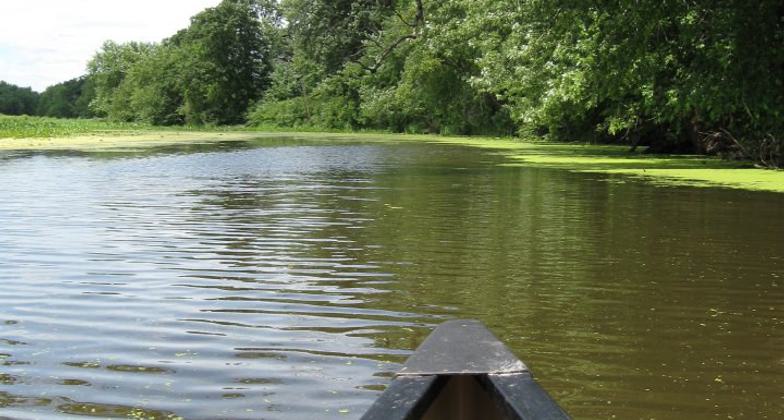
Paddling on the Mississippi River is quite enticing but also challenging. Refuge Staff often hear, "Will I get lost in the backwater sloughs? How will I find my way out?" This 11.2-mile challenging trail is posted for counter-clockwise travel. It is best for stronger, experienced paddlers, as there is a lot of upstream paddling and the current can be strong. During low water, rock obstructions are exposed and paddlers may need to portage. Trails users also may wish to enter and explore the slow/no wake and electric motor areas.
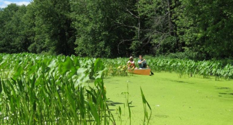
The canoe trail on the Upper Mississippi River National Wildlife and Fish Refuge offers an experience to explore off the main commercial navigation channel. The slower current, lotus beds, and side channels offer an experience reminiscent of the days of Tom Sawyer and Huck Finn. The slower pace allows a paddler to view bald eagles soaring and resting in cottonwoods along the shore. Trail users traveling in spring and fall experience bird migration. Early spring allows paddling before the water plants grow. The hot summers along the Mississippi mean hardy paddlers will need to push canoes or kayaks through the beds of lotus. Every season offers the river paddler an experience to immerse themselves in the Upper Mississippi River National Wildlife and Fish Refuge. which stretches along the Mississippi River and includes Districts in Minnesota, Iowa, Wisconsin, and Illinois. The Refuge is part of the Upper Mississippi River National Wildlife Refuge Complex, which also includes the Trempealeau National Wildlife Refuge in Wisconsin and the Driftless Area National Wildlife Refuge in Iowa.
Established in 1924, the 240,000-acre Upper Mississippi River National Wildlife and Fish Refuge cover 261 miles of the River valley from Wabasha, Minnesota, to Rock Island, Illinois. The Refuge is divided into four districts, the Savanna District, the Winona District, the McGregor District, and the La Crosse District.
The Refuge includes broad pools, islands, braided channels, extensive bottomland forest, floodplain marshes, and occasional sand prairie. These habitats are critical to mammals, waterfowl, songbirds and raptors, amphibians, and reptiles. More than 250 Bald Eagle nests and a yearly average of 15 active Heron colonies with a total of 5,000 nests exist on the Refuge. The Refuge and the River support 119 fish species that support a strong commercial and recreational fishery.
Paddling on the Mississippi River
- Always wear a properly fitted personal flotation device (PFD).
- Tell someone where you will put in, take out, and your return time.
- Thunderstorms can develop quickly. Check the weather forecast before heading onto the water. If a storm approaches, get off the water.
- There are no restrictions on where canoes can go in Mississippi River backwaters. If you feel comfortable, explore off-trail.
- Be aware of river traffic. Motorboats and barges can throw large waves which can swamp a canoe.
- Some areas along canoe trails are popular with hunters. Be extra cautious when canoeing during hunting seasons.
- Make yourself visible - wear bright colors, put reflective tape on your paddle or boat, and carry a light and whistle.
- The bluffs can "tunnel" the wind making it stronger and causing more waves, especially in open areas.
- Be aware of currents. If you begin moving too fast, paddle toward the shore.
- Backwaters can be dangerous if the water is high and the current is flowing through log jams, snags, and low-hanging branches.
- Scout ahead for possible hazards and portage areas.
Accessibility Information
No text provided.
Allowed Uses:
Boating, motorized Boating, human-powered Swimming Dogs, off leash Snow, snowshoeingOther Activities
- Camping
- Fishing
- Hunting
- Snow, snow play general
- Wildlife viewing / observation
Public Contact
Mary StefanskiUpper Mississippi River National Wildlife Refuge
Upper Mississippi River National Wildlife Refuge
Winona, MN 55987
[email protected] • 507 494 6229
More Details
- Elevation (low): --
- Elevation (high): --
- Elevation (cumulative): --
- Part of a Trail System? No
- Surface (primary): Paved
- Surfaces (additional): Water, slow moving
- Tread Width (average): 0"
- Tread Width (minimum): 0
- Running length (minimum): --
- Tread Grade (average, percent): --
- Tread Grade (maximum):
- Running length (maximum): --
- Cross-slope (average, percent): 0
- Cross-slope (maximum): --
- Running length (maximum): --
- Certified as an NRT
May 29, 2012


