Village Creek - Lake Dunn Trail
check with the trail manager for updated details before visiting.
Village Creek - Lake Dunn Trail
State
Frontcountry Trail
- Length
7 miles
- Elevation Gain
--
- Route Type
out & back
- Length
7 miles - Elevation Gain
-- - Route Type
out & back
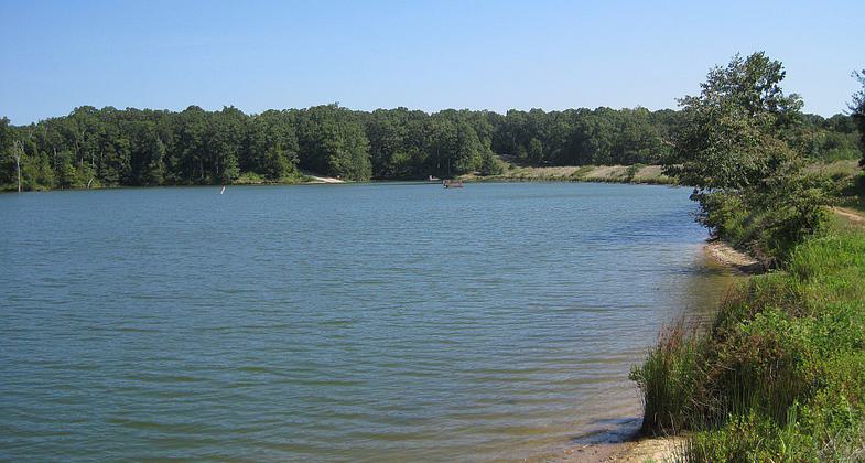
Village Creek State Park south of Wynne, Arkansas. Photo by Thomas R Machnitzki.

Village Creek State Park south of Wynne, Arkansas. Photo by Thomas R Machnitzki.

Village Creek State Park south of Wynne, Arkansas. Photo by Thomas R Machnitzki.
Location: At Village Creek State Park just E of Wynne.
- States: Arkansas
The Lake Dunn Trail's northern trailhead is at the Lake Dunn Dam and is also accessible from the park's campground. Or via a connecting hike/bike trail from the Visitors' Center parking lot.
The 2.77-mile one-way Lake Dunn Trail takes you on an easy walk around the shore before veering off into the deep forest. Rather than backtrack, use connecting trails to form a roughly 7-mile loop back to your starting point. If you don't mind sharing space with bikers and equestrians, veer east onto the park's multi-use trails and take one of the northbound trails back through the woods to the banks of Lake Dunn. A full trail map is available on the park's website.
Accessibility Information
No text provided.
Allowed Uses:
Hiking/WalkingPublic Contact
Village Creek State ParkRoute 3
Wynne, AR 72396
Contact the trail manager for current maps and visiting details.
More Details
- Elevation (low): --
- Elevation (high): --
- Elevation (cumulative): --
- Part of a Trail System? No
- Surface (primary): --
- Surfaces (additional): --
- Tread Width (average): 0"
- Tread Width (minimum): --
- Running length (minimum): --
- Tread Grade (average, percent): --
- Tread Grade (maximum):
- Running length (maximum): --
- Cross-slope (average, percent): --
- Cross-slope (maximum): --
- Running length (maximum): --
- Certified as an NRT
Jun 7, 1981