Village of Bluffton Pathway
This information is a public record of the 2003 NRT application and may be out of date if it has not been updated by a trail manager --
check with the trail manager for updated details before visiting.
check with the trail manager for updated details before visiting.
Village of Bluffton Pathway
City, Town, or County
Frontcountry Trail
Rail Trail
- Length
2.85 miles
- Elevation Gain
--
- Route Type
out & back
- Length
2.85 miles - Elevation Gain
-- - Route Type
out & back
Location: Village of Bluffton
- States: Ohio
- Counties: Allen
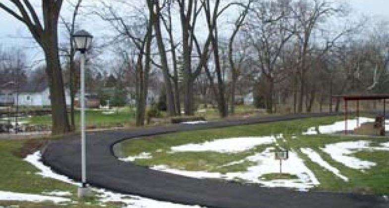
This bike trail is predominantly scenic. It starts at the Buckeye Park and trails around the quarry. Then it has a short stint on a nice quiet street, passes the arboretum, and then hops back onto a scenic path around a large quarry. From the National Quarry, it leads back to a slow-paced roadway that takes one across town. And now, we are back to the path through wooded lots and second-growth flood plain. Under I-75 you go on to the Village Park. Once on park ground, the path follows through the woods beside a creek and leads to other park facilities.
Accessibility Information
No text provided.
Allowed Uses:
Bicycling Boating, human-powered Dogs, on leash Equestrian Hiking/WalkingOther Activities
- Camping
Public Contact
Nancy L. BenrothVillage of Bluffton Park & Recreation Board
100 E. Elm St.
Bluffton, OH 45817
[email protected] • (419) 358-2066
Contact the trail manager for current maps and visiting details.
More Details
- Elevation (low): --
- Elevation (high): --
- Elevation (cumulative): --
- Part of a Trail System? No
- Surface (primary): Paved
- Surfaces (additional): Paved
- Tread Width (average): 120"
- Tread Width (minimum): --
- Running length (minimum): --
- Tread Grade (average, percent): 1
- Tread Grade (maximum):
- Running length (maximum): --
- Cross-slope (average, percent): --
- Cross-slope (maximum): --
- Running length (maximum): --
- Certified as an NRT
Jun 4, 2003


