Virginia Creeper
check with the trail manager for updated details before visiting.
Virginia Creeper
USDA Forest Service
Backcountry Trail
Rail Trail
- Length
33.4 miles
- Elevation Gain
--
- Route Type
out & back
- Length
33.4 miles - Elevation Gain
-- - Route Type
out & back
The Virginia Creeper is a shared-use trail connecting Abingdon, Virginia, with the Virginia-North Carolina border 1.1 miles east of Whitetop Station, Virginia. The total length of the trail is 33.4 miles.

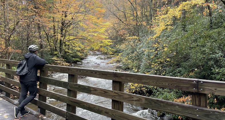
Taking in the view along the Virginia Creeper Trail. Photo by Jennifer Wampler.

Virginia Creeper - Mount Rogers National Recreation Area - near Damascus. Photo by Jim Walla.

Virginia Creeper - Mount Rogers National Recreation Area - near Damascus. Photo by Jim Walla.

Green Cove Station Visitor Center on the Virginia Creeper Trail.

Location: Suburban/Rural
- States: Virginia
- Counties: Washington
Virginia's finest rail trail, the Virginia Creeper National Recreation Trail occupies the bed of what was once a rugged mountain railroad between Abingdon and the Virginia-North Carolina border about a mile east of Whitetop Community. At the trail's lowest point, where it crosses South Holston Lake on a huge curving trestle, it is 2,000 feet above sea level, but, by the time it reaches Whitetop Community, it has ascended 1,600 feet, some of it at nearly 7 percent grade!
The trail began as a Native American footpath. Later it was used by European pioneers including Daniel Boone. By 1907, W.B. Mingea had constructed the Virginia-Carolina Railroad from Abingdon to Damascus. In 1905 the line was extended by Hassinger Lumber Co. to Konnarock and Elkland, NC. It hauled lumber, iron ore, supplies, and passengers. It got its nickname "Virginia Creeper" from the early steam locomotives as they struggled slowly up steep grades.
With about 100 trestles and bridges, sharp curves, and steep grades, the Virginia Creeper was the quintessential mountain railroad. Crews faced wash-outs, rock slides, and other hazards, but it was economics that sounded the line's death whistle. Having failed to turn a profit since the Great Depression, the Creeper ran its last train on March 31, 1977.
From Abingdon to Damascus, the trail right-of-way belongs to the two towns, but most of the actual land is private. While you do have the right to use the trail across their property, please respect landowners. Stay on the trail, close gates, keep dogs under control, don't frighten livestock, and be friendly!
The trail between Damascus and the North Carolina border, except for a short stretch through Taylor's Valley, is administered by the Mount Rogers National Recreation Area staff.
Accessibility Information
No text provided.
Allowed Uses:
Hiking/WalkingPublic Contact
Barry GartenMt. Rogers National Recreation Area
Marion, VA 24354
(540) 783-5196
www.fs.usda.gov/attmain/gwj/specialplace
Contact the trail manager for current maps and visiting details.
More Details
- Elevation (low): --
- Elevation (high): --
- Elevation (cumulative): --
- Part of a Trail System? No
- Surface (primary): Rock, crushed
- Surfaces (additional): --
- Tread Width (average): 96"
- Tread Width (minimum): --
- Running length (minimum): --
- Tread Grade (average, percent): 2
- Tread Grade (maximum):
- Running length (maximum): --
- Cross-slope (average, percent): --
- Cross-slope (maximum): --
- Running length (maximum): --
- Certified as an NRT
Sep 7, 1985

