Waccamaw River Blue Trail
check with the trail manager for updated details before visiting.

Waccamaw River Blue Trail
Nonprofit
National Water Trail
- Length
100 miles
- Elevation Gain
--
- Route Type
out & back
- Length
100 miles - Elevation Gain
-- - Route Type
out & back
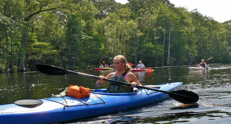
The Waccamaw River Blue Trail extends the South Carolina portion of the Waccamaw River meandering 100 miles through protected bottomland hardwood swamps of the Waccamaw National Wildlife Refuge and passing through the historic, riverfront cities of Conway and Georgetown. The Waccamaw, a coastal black water river, is home to many rare species of plants and animals, some of which are found nowhere else on earth.
Location: The Waccamaw River is located in the coastal plain of South Carolina flowing through urban Conway before emptying into Winyah Bay near Georgetown.
- States: South Carolina
- Counties: Georgetown, Horry
- Cities/Townships: Conway and Georgetown
Recently listed as a priority project of America's Great Outdoors Rivers Initiative, the Waccamaw River is a defining part of the region's landscape. Its historical, cultural, and natural significance cannot be understated since the river provides clean drinking water, a home for fish and wildlife, scenic landscapes, and opportunities for outdoor recreation.
The Waccamaw River Blue Trail meanders through the Waccamaw River Heritage Preserve and the Waccamaw National Wildlife Refuge before merging with the Intracoastal Waterway where the river widens, passing by historic rice fields, Brookgreen Gardens, Sandy Island, and ending at Winyah Bay near Georgetown.
Over 100 miles of river invite the paddler to explore its unique natural, historical, and cultural features. Its black waters, cypress swamp, and tidal marshes are home to many rare species of plants and animals. The river is steeped in history with Native American settlements, Civil War sites, rice and indigo plantations with their Gullah-Geechee culture, and historic communities and industries that were once served by steamships.
The Blue Trail also connects the protected lands of the Waccamaw River Heritage Preserve, the Waccamaw National Wildlife Refuge, and the North Inlet-Winyah Bay Estuarine Research Reserve to Conway and Georgetown's historic, riverfront cities.
Accessibility Information
No text provided.
Allowed Uses:
Boating, motorized Boating, human-powered SwimmingOther Activities
- Camping
- Fishing
- Heritage and history
- Wildlife viewing / observation
Public Contact
Christine EllisWinyah Rivers Foundation
P.O. Box 261954
Conway, SC 29528
[email protected] • (843) 349-4007
More Details
- Elevation (low): --
- Elevation (high): --
- Elevation (cumulative): --
- Part of a Trail System? No
- Surface (primary): --
- Surfaces (additional): --
- Tread Width (average): 0"
- Tread Width (minimum): 0
- Running length (minimum): --
- Tread Grade (average, percent): --
- Tread Grade (maximum):
- Running length (maximum): --
- Cross-slope (average, percent): 0
- Cross-slope (maximum): --
- Running length (maximum): --
- Certified as an NRT
Mar 10, 2013


