Warriors Passage
check with the trail manager for updated details before visiting.
Warriors Passage
USDA Forest Service
- Length
6.2 miles
- Elevation Gain
--
- Route Type
out & back
- Length
6.2 miles - Elevation Gain
-- - Route Type
out & back
Location: Tellico Ranger District of the Cherokee National Forest, In Cherokee National Forest SE of Tellico Plains on county rd. 76 along Wildcat Creek.
- States: Tennessee
- Counties: Bradley
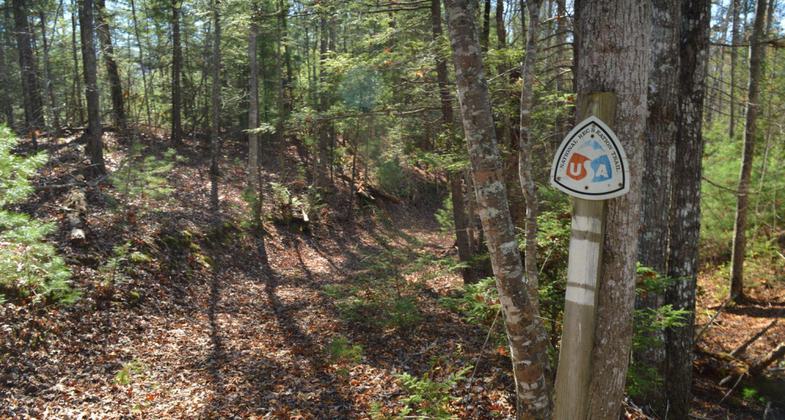
From the bald, hike 0.8 miles down the Waucheesi Mountain Road to where the trail leaves the road. The bald itself and the hike down the road offers majestic views of the surrounding mountain ridges, many of which exceed 5000 feet in elevation. At mile 0.8, leave the road down a steep slope off the edge of the road to the left. A post with the Warrior's Passage symbol marks the start of the trail. The trail quickly levels out and descends the steep slope of the mountain in a series of switchbacks in mature hardwoods. At mile 1.5, the trail enters an area of pine recovery after a forest fire in the late 1990s; thus the trees recovering are over 10 years old and are growing very densely. The trail forms a tunnel through this dense pine foliage. Many old dead pine trees are still standing and you may have to cross over some of these trees if high winds have knocked them down since the last trail maintenance. At mile 1.8, you again enter a mixed pine and hardwood forest down a steep ridgeline between Tobe Creek on your right and Rocky Branch on your left. At mile 2.1, you reach Mule Pen Gap and cross a gated forest service road right by the gate. From here you skirt along the north side of a ridge then travel down the ridgeline to a crossing over Tobe Creek at mile 3.3. At mile 3.6 you cross Bald River Road and head uphill through another heavily burned-over area of more recent vintage. These areas of forest were burned over in the late 90s. These areas afford great views and an
opportunity to see a forest recovering after a fire. These fires caused closure of the trail until 2008 when the trail was reopened after many hours of labor by volunteers. After crossing the ridgeline, the unburned forest returns, and the trail heads downhill to cross over Wildcat Creek Road at mile 4.0. The trail heads more or less north for a way, somewhat paralleling the road, then leaves the road and heads downhill to Wildcat Creek. Cross Wildcat Creek at mile 5.3. In high water, this crossing may be difficult and dangerous since this is a fairly large but beautiful creek. Expect to get your feet wet even at times of low water. There is an excellent campsite on the west side of the creek. Follow the trail to its end uphill to the Lyons Creek (Old Furnace) Road at mile 6.3.
Accessibility Information
No text provided.
Allowed Uses:
Hiking/WalkingPublic Contact
Cherokee National ForestP.O. Box 2010
Cleveland, TN 37311
Contact the trail manager for current maps and visiting details.
More Details
- Elevation (low): 1412
- Elevation (high): 3692
- Elevation (cumulative): --
- Part of a Trail System? No
- Surface (primary): --
- Surfaces (additional): --
- Tread Width (average): 0"
- Tread Width (minimum): --
- Running length (minimum): --
- Tread Grade (average, percent): --
- Tread Grade (maximum):
- Running length (maximum): --
- Cross-slope (average, percent): --
- Cross-slope (maximum): --
- Running length (maximum): --
- Certified as an NRT
Dec 12, 1979


