Washburn Discovery Trail
check with the trail manager for updated details before visiting.
Washburn Discovery Trail
City, Town, or County
Backcountry Trail
- Length
2.2 miles
- Elevation Gain
--
- Route Type
out & back
(1 review)
- Length
2.2 miles - Elevation Gain
-- - Route Type
out & back
Location: Washburn, North Dakota, In Washburn, connects Lewis & Clark Visitor Center to Riverside Park.
- States: North Dakota
- Counties: McLean
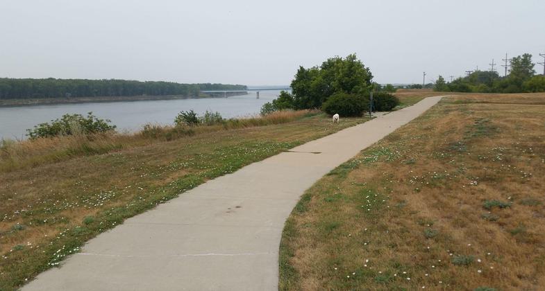
The Washburn Discovery Trail begins in Harmony Park at the North Dakota Lewis & Clark Interpretive Center, a certified Lewis & Clark National Historic Trail site. The concrete trail proceeds to Washburn's Riverside Park, taking in vistas of the Missouri River along the way. Throughout the route, historic sites, from the location of North Dakota's first coal-fired power plant; to the bridge spanning the Missouri River; to the last operating ferry boat on the River in North Dakota; to historic Washburn Landing; to the Soo Line Railroad are marked with interpretive signs, benches, and other walking/hiking amenities. The trail utilizes innovative and environmentally friendly fly ash-based concrete. A variety of partnerships, including the City of Washburn, Lewis & Clark Fort Mandan Foundation, and Washburn Area Convention & Visitors Bureau are making this new trail (opened in 2005) a popular feature for locals and tourists alike.
Accessibility Information
No text provided.
Reviews
Trail is very nice. Has lots of scenic views and places to stop and sit. Goes through a nice park right next to the river.
Allowed Uses:
Bicycling Boating, motorized Dogs, on leashOther Activities
- Camping
- Fishing
Public Contact
David BorlaugWashburn Area CVB
PO Box 607
Washburn, ND 58577
[email protected] • (701) 462-8530
www.washburnnd.com
Contact the trail manager for current maps and visiting details.
More Details
- Elevation (low): 1682
- Elevation (high): 1863
- Elevation (cumulative): --
- Part of a Trail System? No
- National Designations: Lewis & Clark National Historic Trail
- Surface (primary): Paved
- Surfaces (additional): Paved
- Tread Width (average): 96"
- Tread Width (minimum): --
- Running length (minimum): --
- Tread Grade (average, percent): 2
- Tread Grade (maximum): 8
- Running length (maximum): --
- Cross-slope (average, percent): --
- Cross-slope (maximum): --
- Running length (maximum): --
- Certified as an NRT
May 31, 2006


