West Lost Creek Trail
This information is a public record of the 1979 NRT application and may be out of date if it has not been updated by a trail manager --
check with the trail manager for updated details before visiting.
check with the trail manager for updated details before visiting.
West Lost Creek Trail
USDA Forest Service
- Length
7.5 miles
- Elevation Gain
--
- Route Type
out & back
- Length
7.5 miles - Elevation Gain
-- - Route Type
out & back

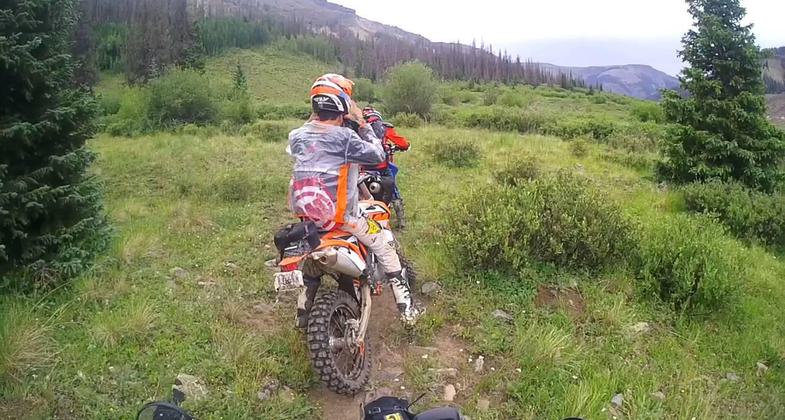
Dirt biking West Lost Trail. Photo courtesty of https://www.uncovercolorado.com/. Photo by Uncovercolorado.com.
Location: SW from Creede on SR 149 20.1 mi. to FS Rd. 520, W 16.5 mi. to trailhead.
- States: Colorado
The West Lost Trail is 7.0 miles long. It begins at Forest Trail 821 and ends at CDNST 813.
Beautiful views of Pole Mountain and vast panoramic views are possible once a hiker begins approaching the Continental Divide. This trail provides the shortest access to Cataract Lake from the Rio Grande River drainage. Occasionally bighorn sheep can be seen along the rugged ridges of Pole Mountain.
The trail is open for the following uses: Motorcycle Trail Riding, Mountain Biking, Foot and Horse Travel.
Accessibility Information
No text provided.
Allowed Uses:
Dogs, on leash Equestrian Hiking/Walking Motorized vehicles, motorcyclingOther Activities
- Camping
- Fishing
Public Contact
Art MarcillaRio Grande National Forest
Divide Ranger District
Del Norte, CO 81132
amarcilla/[email protected] • (719) 657-3321
Contact the trail manager for current maps and visiting details.
More Details
- Elevation (low): --
- Elevation (high): --
- Elevation (cumulative): --
- Part of a Trail System? No
- Surface (primary): --
- Surfaces (additional): --
- Tread Width (average): 39"
- Tread Width (minimum): --
- Running length (minimum): --
- Tread Grade (average, percent): --
- Tread Grade (maximum):
- Running length (maximum): --
- Cross-slope (average, percent): --
- Cross-slope (maximum): --
- Running length (maximum): --
- Certified as an NRT
Nov 15, 1979

