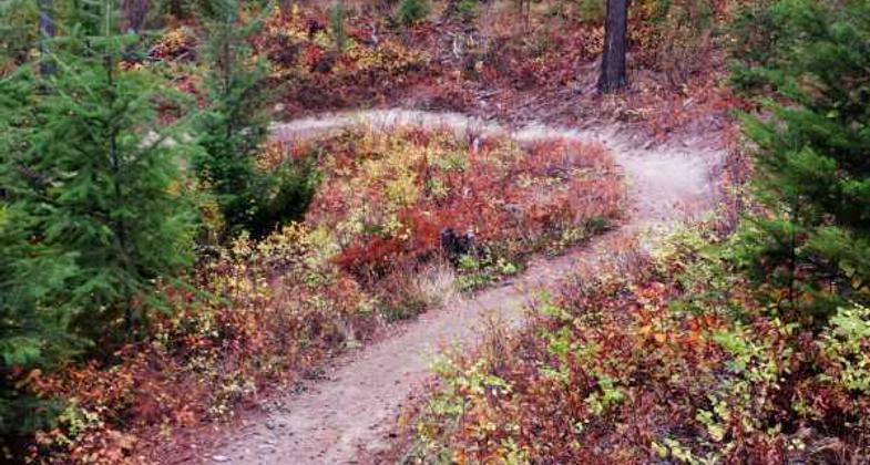
Whitefish Divide (Smokey Range)
This information is a public record of the 1979 NRT application and may be out of date if it has not been updated by a trail manager --
check with the trail manager for updated details before visiting.
check with the trail manager for updated details before visiting.
Whitefish Divide (Smokey Range)
USDA Forest Service
Backcountry Trail
- Length
11 miles
- Elevation Gain
--
- Route Type
out & back
- Length
11 miles - Elevation Gain
-- - Route Type
out & back
Location: In the Flathead National Forest, 6 mi. north of Whitefish.
- States: Montana
- Counties: Flathead
Whitefish Divide Trail, a ridgeline trail, is one of the main feeder trails in the Thompson Seton Proposed Wilderness. It accesses several high mountain lakes and a number of trails that lead into both the Kootenai and Flathead portions of the Thompson Setons. It offers sensational vistas of Glacier National Park, Flathead Valley, and Cabinet Mountains. Hiking difficulty varies from moderate to difficult.
Accessibility Information
No text provided.
Allowed Uses:
Bicycling Dogs, on leash EquestrianOther Activities
- Camping
Public Contact
Fred FlintUS Forest Service
P.O. Box 190340
Hungry Horse, MT 59919
[email protected] • (406) 387-3800
Contact the trail manager for current maps and visiting details.
More Details
- Elevation (low): 6000
- Elevation (high): 7196
- Elevation (cumulative): --
- Part of a Trail System? No
- National Designations: National Millenium
- Surface (primary): Soil
- Surfaces (additional): Soil
- Tread Width (average): 0"
- Tread Width (minimum): --
- Running length (minimum): --
- Tread Grade (average, percent): 8
- Tread Grade (maximum): 20
- Running length (maximum): --
- Cross-slope (average, percent): --
- Cross-slope (maximum): --
- Running length (maximum): --
- Certified as an NRT
Jan 4, 1979


