Whitney Portal
check with the trail manager for updated details before visiting.
Whitney Portal
USDA Forest Service
- Length
3.9 miles
- Elevation Gain
--
- Route Type
out & back
- Length
3.9 miles - Elevation Gain
-- - Route Type
out & back
Trail connects the Mt. Whitney Trailhead to the Lone Pine Campground at the bottom of the canyon.

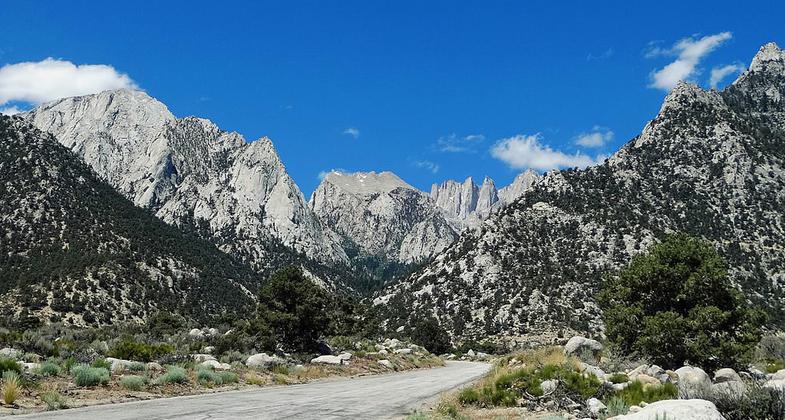
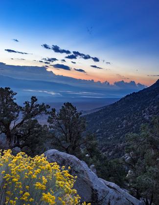
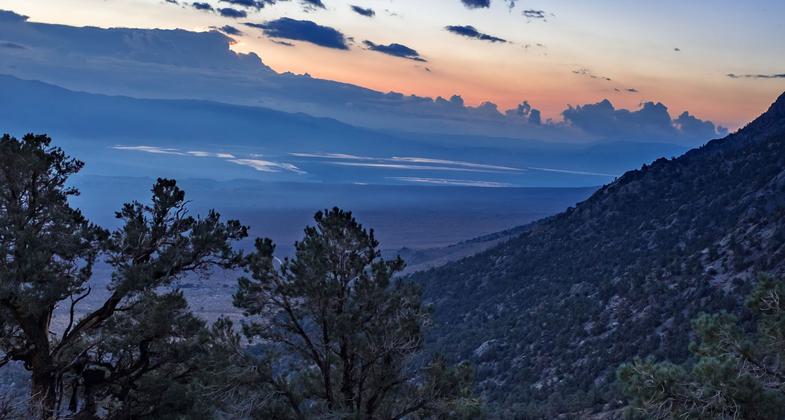
The Whitney Portal is 13 miles west of Lone Pine, CA, at the end of Whitney Portal Road. It is in a heavily wooded canyon, with. Photo by inkknife_2000.


Mount Whitney Trailhead. Photo by daveynin.
Location: Rural, Lone Pine Campground, Whitney Portal Road.
- States: California
- Counties: Inyo
Outstanding views of Mount Whitney (the highest peak in the continental United States) and the eastern Sierra escarpment, Lone Pine Creek, the Alabama Hills, and the White and Inyo Mountains are the key features of the Whitney Portal National Recreation Trail. The trail begins in the Lone Pine Campground at 5,900 feet elevation in the Great Basin Desert and climbs four miles along the south rim of Lone Pine Creek to Whitney Portal at 8,400 feet elevation in the sub-alpine zone of the Sierra Nevada.
The lower portion of the trail is open year-round. Although it can be hot on summer days, it offers an impressive wildflower display in the spring. The upper trail segment receives winter snow but provides a pleasant walk through a forested stream canyon for the rest of the year. The Whitney Portal Road is closed due to snow in the winter, which restricts access to the upper trailhead. Unlike the trail that leads from Whitney Portal to Mt. Whitney, there are no use quotas established for the National Recreation Trail, which allows visitors to experience this area without a permit. The Lone Pine Campground provides an excellent spot to base camp and hike this scenic trail.
Accessibility Information
No text provided.
Allowed Uses:
Dogs, on leash Hiking/WalkingOther Activities
- Camping
- Wildlife viewing / observation
Public Contact
Martin HornickInyo National Forest
873 North Main St.
Bishop, CA 93514
(760) 873-2461
Contact the trail manager for current maps and visiting details.
More Details
- Elevation (low): --
- Elevation (high): --
- Elevation (cumulative): --
- Part of a Trail System? No
- Surface (primary): --
- Surfaces (additional): --
- Tread Width (average): 30"
- Tread Width (minimum): --
- Running length (minimum): --
- Tread Grade (average, percent): --
- Tread Grade (maximum):
- Running length (maximum): --
- Cross-slope (average, percent): --
- Cross-slope (maximum): --
- Running length (maximum): --
- Certified as an NRT
Nov 15, 1979


