Willows Trail
check with the trail manager for updated details before visiting.
Willows Trail
U.S. Fish and Wildlife Service
Backcountry Trail
- Length
0.8 miles
- Elevation Gain
--
- Route Type
out & back
- Length
0.8 miles - Elevation Gain
-- - Route Type
out & back

Viewing bench. Photo by Anahuac NWR.

Bridge and refuge. Photo by Anahuac NWR.

Boardwalk on the Willows Trails. Photo by Anahuac NWR.

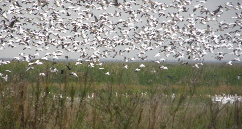
Snow Geese in the Anahuac Wildlife Refuge. Photo by Linda MacPhee-Cobb.

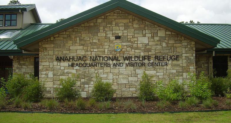
Anahuac National Wildlife Refuge headquarters. Photo by WhisperToMe.
Location: Anahuac National Wildlife Refuge, southeast of Double Bayou.
- States: Texas
- Counties: Chambers
Located on Anahuac National Wildlife Refuge, the Willows Trail connects the Visitor Information Station and the Butterfly and Hummingbird Habitat Landscape to "The Willows," a popular destination for birders on the upper Texas coast. The coastal woodlot located at the Willows provides important stopover habitat for migratory birds making the 600-mile journey across the Gulf of Mexico each spring. The trail meanders through this coastal woodlot, freshwater ponds, a prairie restoration demonstration area, and a landscape designed to attract butterflies and hummingbirds. These habitats offer outstanding views of migrating songbirds, wading birds, butterflies, and a variety of other wildlife.
The 0.8-mile Willows Trail includes a 1,000-foot stained and stamped concrete path leading to a 1,100-foot elevated boardwalk constructed of environmentally friendly and long-lasting recycled plastic decking. This universally-accessible portion of the trail provides wildlife-viewing opportunities for people of all abilities. The remainder of the trail consists of a mowed grass path looping around the willows and leading back to the Visitor Information Station. The Willows Trail is located at the main entrance to the Refuge and provides students participating in the refuge's Outdoor Education Program, as well as all visitors, with excellent opportunities to experience the wildlife and habitats that occur on the refuge.
The trail was made possible through a partnership with the Friends of Anahuac Refuge, the National Fish and Wildlife Foundation, the U.S. Fish and Wildlife Service, and many additional contributors and volunteers.
Accessibility Information
No text provided.
Allowed Uses:
Hiking/WalkingOther Activities
- Wildlife viewing / observation
Public Contact
Shaun SanchezU.S. Fish & Wildlife Service
P.O. Box 278
Anahuac, TX 77514
[email protected] • (409) 267-3337
www.fws.gov/southwest/refuges/texas/anahuac
Contact the trail manager for current maps and visiting details.
More Details
- Elevation (low): 3
- Elevation (high): 6
- Elevation (cumulative): --
- Part of a Trail System? No
- Surface (primary): Boardwalk
- Surfaces (additional): Paved, Grass or Vegetation, Soil
- Tread Width (average): 48"
- Tread Width (minimum): --
- Running length (minimum): --
- Tread Grade (average, percent): --
- Tread Grade (maximum): 5
- Running length (maximum): --
- Cross-slope (average, percent): --
- Cross-slope (maximum): --
- Running length (maximum): --
- Certified as an NRT
May 31, 2007

