Yakima Greenway Path
check with the trail manager for updated details before visiting.
Yakima Greenway Path
Nonprofit
Frontcountry Trail
- Length
10 miles
- Elevation Gain
--
- Route Type
out & back
- Length
10 miles - Elevation Gain
-- - Route Type
out & back

North, where the 6th Avenue bike trail meets the Yakima Greenway, under the shadow of Highway 12. Photo by September Autumnleaf/wiki.

Looking east down a long stretch of the Yakima Greenway that runs from 40th Ave to 16th ave, along Highway 12. Photo by September Autumnleaf/wiki.

Photo by September Autumnleaf.

Location: Urban
- States: Washington
- Counties: Yakima
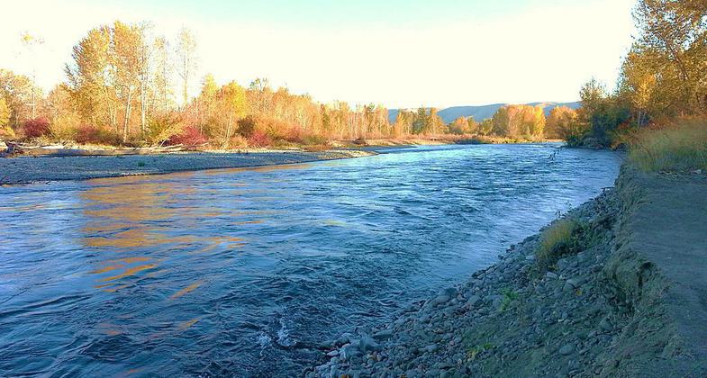
Located in Central Washington state, the Yakima Greenway boasts ten miles of paved pathway, three parks, two fishing lakes, and four river access landings along with protected and natural areas. Greenway facilities are free and open to the public year-round, from dawn to dusk.
The Yakima Greenway Path was designated a National Recreation Trail by the U.S. Department of the Interior in 1993, bringing it into the nation's system of excellent trails. The pathways are patrolled by Greenway's Courtesy Cart and by Yakima and Union Gap bicycle police.
The Greenway is the perfect place for walking, bird watching, fishing, running, biking, skating, picnicking, and enjoying healthy outdoor activities in solitude or with friends and family. It is wheelchair accessible, with fishing piers designed for the disabled at Rotary Lake.
The Greenway is fondly known as "The Jewel of Yakima" and is a favorite place enjoyed and supported by thousands of residents and visitors every year. There is no place else like it in the Yakima Valley!
Accessibility Information
No text provided.
Allowed Uses:
Bicycling Dogs, on leash Hiking/Walking Snow, cross-country skiing Snow, snowshoeingOther Activities
- Fishing
- Snow, snow play general
- Wildlife viewing / observation
Public Contact
Cecilia VogtYakima Greenway Foundation
111 S. 18 St.
Yakima, WA 98901
[email protected] • (509) 453-8280
Contact the trail manager for current maps and visiting details.
More Details
- Elevation (low): --
- Elevation (high): --
- Elevation (cumulative): --
- Part of a Trail System? No
- Surface (primary): Paved
- Surfaces (additional): --
- Tread Width (average): 120"
- Tread Width (minimum): --
- Running length (minimum): --
- Tread Grade (average, percent): --
- Tread Grade (maximum):
- Running length (maximum): --
- Cross-slope (average, percent): --
- Cross-slope (maximum): --
- Running length (maximum): --
- Certified as an NRT
Oct 28, 1992

