York
check with the trail manager for updated details before visiting.
York
City, Town, or County
- Length
3.5 miles
- Elevation Gain
--
- Route Type
out & back
(1 review)
- Length
3.5 miles - Elevation Gain
-- - Route Type
out & back
Location: In Oakland's Leona Canyon.
- States: California
- Counties: Alameda
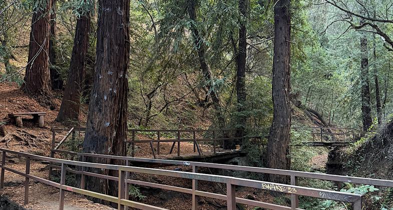
The main trail through Leona Heights Park is the York Trail, a linear trail connecting the lower portion of the park at Mountain Boulevard to the upper portion near Merritt College. The lower entrance of the trail runs its course along Horseshoe Creek and through second-growth redwood groves that after many years since logging ceased in the area have grown to impressive heights. As the trail makes its way up the canyon the habitat transitions to an oak woodland habitat filled with bay trees, thimbleberries, wildflowers, and the city's namesake tree, the coast live oak. The trail eventually joins a fire road. This fire road starts from McDonnell Avenue and because of this, the fire road carries an unofficial title of McDonnell Trail. It should be noted that a majority of the land that the fire road winds through is privately owned. If the visitor continues in an easterly direction along the McDonnell Fire road the visitor will be led to another junction which can lead them to the alternate entrance to the park at 12500 Campus Drive or up to the old abandoned parking lot for Merritt College.
Accessibility Information
No text provided.
Reviews
Patricia Ellis
Great trail, just needs a little maintenance
Hiked Nov 9, 2024. The 3.5-mile York Trail is rugged and steep and, if you are heading east, entirely uphill. There are narrow parts where the dirt is eroding into the creek far below, and you could take quite a nasty tumble if you aren’t careful. Redwoods and then oaks tower overhead. It’s a lovely bit of nature nestled within Oakland. The trail leads to a fantastic viewpoint where one can see SF, the Bay, Oakland, etc stretched out below you. The eastern terminus is in an abandoned and gated parking area by Merritt College. I had fun trying to get on the other side of the gate…finally found a place where the gate had been cut. The trailhead itself has no sign so, all things considered, this trail may not be getting regular maintenance love. Gave it four stars instead of five because the trailhead areas are not clear/feel abandoned, there are parts of the trail that are eroding, and there are no blazes and almost no signs. Still an enjoyable hike though.
Allowed Uses:
Hiking/WalkingPublic Contact
Martin MatarreseOakland Office of Parks and Recreation
3590 Sanborne Dr.
Oakland, CA 94602
Contact the trail manager for current maps and visiting details.
More Details
- Elevation (low): --
- Elevation (high): --
- Elevation (cumulative): --
- Part of a Trail System? No
- Surface (primary): --
- Surfaces (additional): --
- Tread Width (average): 0"
- Tread Width (minimum): --
- Running length (minimum): --
- Tread Grade (average, percent): --
- Tread Grade (maximum):
- Running length (maximum): --
- Cross-slope (average, percent): --
- Cross-slope (maximum): --
- Running length (maximum): --
- Certified as an NRT
Aug 21, 1974


